How to Hike the Tongariro Crossing: New Zealand’s Epic Volcano Trail
Quick Facts
The Tongariro Crossing is a challenging but unforgettable day hike on New Zealand’s North Island. Covering 19.5 km point-to-point, it takes you through volcanic landscapes, steaming craters, and lava fields. Mount Ngauruhoe, also known as “Mount Doom” from Lord of the Rings, is the highlight of the trail.
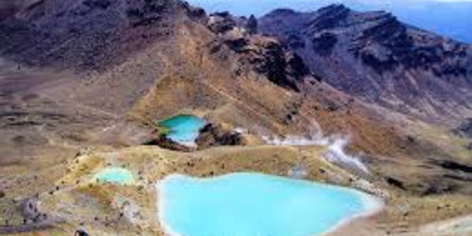
Expect a full day of hiking, with steep ascents like the Devil’s Staircase and stunning viewpoints at Red Crater and the Emerald Lakes. The trail ends at Ketetahi Car Park, so a shuttle from the start at Mangatepopo is required.
Sections of the hike:
Mangatepopo → Soda Springs: Easy walk past marshes and volcanic rocks.
Soda Springs → South Crater: Moderate/difficult climb up the Devil’s Staircase.
South Crater → Red Crater: Steep ascent to the ridge, windy and gravelly.
Red Crater → Blue Lake: Scenic descent past Emerald Lakes.
Blue Lake → Ketetahi Shelter: Gentle descent with views of plains and Lake Rotoaira.
Ketetahi Shelter → Ketetahi Car Park: Easy final descent through forest.
Tips for hikers:
Carry 2L+ water per person.
Wear sturdy hiking shoes and a jacket.
Bring snacks, a camera, and optionally a headlamp.
Shuttles from Ketetahi Car Park to Mangatepopo are essential.
Best time to go: November to April. Avoid winter months unless experienced in snow hiking.
Quick Stats:
Distance: 19.5 km (point-to-point)
Elevation Gain: 765 m
Max Altitude: 1,900 m
Duration: 6–8 hours
Difficulty: Strenuous

Aqsa Zaheer
Writer at The Global Routes, covering destinations, travel guides and lifestyle stories.